Interactive Map: The Vulnerability of America’s Military Bases to Climate Change
Created and Edited by: Sierra Hicks and Esther Babson
The capability of the United States military to protect the United States and advance its interests rests on its ability to respond quickly to any crisis at home or abroad. Climate change will impact the national security of the United States in a myriad of ways and will profoundly impact the ability of the Department of Defense to ensure military readiness. At the installation level, physical changes to the environment will impact the military’s infrastructure, including bases, training fields, and airstrips.
From sea level rise to droughts, wildfires, and floods, each base has unique vulnerabilities. The Department of Defense must prepare for the coming changes by investing in both low-cost short-term solutions, and long-term adaptation strategies. The 2018 National Defense Authorization Act (NDAA) outlines these threats and directs Secretary of Defense Mattis to submit a report within one year on the,
“vulnerabilities to military installations and combatant commander requirements resulting from climate change over the next 20 years. (including) A list of the ten most vulnerable military installations . . . based on the effects of rising sea tides, increased flooding, drought, desertification, wildfires, [and] thawing permafrost”
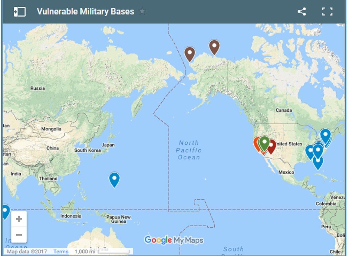
This interactive map highlights some of the most strategically important military installations that are vulnerable to the effects of climate change. Each installation on the map includes information on the threat horizon, type of threat, strategic significance, and specific projections of the impacts the installation could experience in the future. While not comprehensive, we believe this map provides a starting point for analysis.
For more information on ASP’s work around the NDAA, climate security, and related fields, see the resources at the bottom of the page.
Key:
Installations that appear blue on the map are those threatened by sea level rise and flooding, ones in red are threatened by excessive heat, orange designates drought and wildfire threat, green is flash flooding, and brown is coastal erosion. Each installation is categorized by the primary threat it faces, but that does not mean that bases face only one type of threat.
Sources:
- The US Military on the Front Lines of Rising Seas (2016). Union of Concerned Scientists.
- California’s Wildfires Have Become Bigger, Deadlier, and More Costly. Here’s Why. by Laignee Barron (Time).
- Too Hot to Fly? Climate Change May Take a Toll on Air Travel. by Zach Wichter (The New York Times).
- Officials Call Runways Safe at Edwards Air Force Base : Antelope Valley: Inspections are stepped up after the discovery of cracks in dry lake bed landing strips. by John Chandler (LA Times)
- Pentagon to Escalate Global Warming Preparations. by Alan Neuhauser (USA News)
- Topography, Surface Features, and Flooding of Rogers Lake Playa, California. U.S. Geological Survey
- Vegetation fire burns 300+ acres at Vandenberg Air Force Base. by
- Wildfire near Vandenberg Air Force Base swells to over 10,000 acres; Soberanes fire sets cost record. by Hailey Branson-Potts (LA Times)
- What Climate Change Means for Guam. U.S. Environmental Protection Agency.