 Photo Courtesy: Jocelyn Augustino on fema.gov
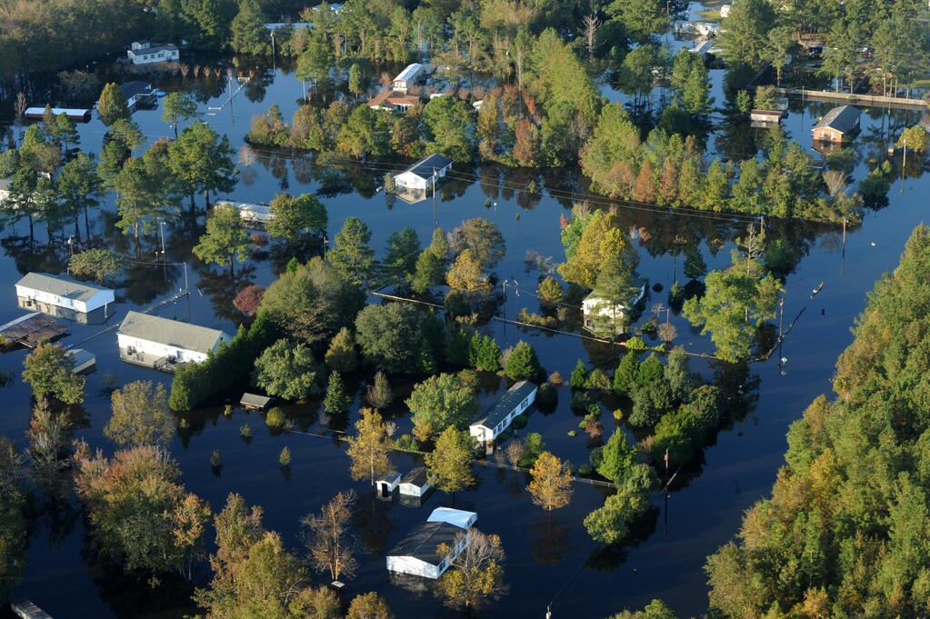
A Flooded Future: New Flood Model Exposes a Grim Reality
A new flood risk model produced by the First Street Foundation found that millions of more homes are serious flood risks than previous Federal Emergency Management Agency (FEMA) models suggest, calling into question the accuracy of FEMA’s flood maps.
What is the Model?
The First Street Foundation is a non-profit research group with the stated goal of making flood risk information publicly available to the American people. First Street’s mission is, in part, a response to the inadequacy of FEMA’s flood maps, maps that are not meant to inform individual property owners of their properties’ flood risk. First Street’s flood model assigns every property in the United States a risk score ranging from 1 to 10 based on a property’s risk of flooding over a 30-year mortgage. These risk scores form a new national flood map that paints a far more accurate picture of the country’s flood risks than current FEMA maps.
What Does the Model Tell Us?
The new model shows about 14.6 million homes and other structures nation-wide have a 1% chance of flooding annually, the threshold the federal government uses to mandate the purchase of flood insurance. The model also reveals that FEMA’s flood models undercount vulnerable properties by 40%, leaving out nearly 6 million homes and commercial properties. The future is grim as well. First Street predicts that another 1.6 million properties will join the 1% club by 2050.
The model also reveals that FEMA’s flood maps—which do not account for intense rainfall—missed millions of properties in the nation’s interior. According to the model, many of these properties are in cities, suggesting that some of the nation’s largest communities are the greatest hidden risks. As an example, in Chicago alone, there are 75,000 properties with previously undisclosed flood risk.
Chicago is emblematic of another trend as well: a significant number of minority communities reside in areas with unmapped flood risk. Englewood—a Chicago neighborhood whose residents are 95 percent Black—is one of the greatest hidden flood risks in the Chicago area. First Street found that minority residents possessed a greater share of undisclosed flood risk than the statewide average in two-thirds of states, suggesting that many cities seem to prioritize flood protection in predominantly white, high-income neighborhoods.
Who is the Model For?
First Street intends for American homeowners to use the model. With the best flood risk information currently available only through for-profit companies, First Street hopes to equip consumers with the publicly-available information they need to make sound real estate decisions. First Street’s secondary clients are the researchers and government employees—to include FEMA—who need better data to assess the risk flooding poses to the nation’s infrastructure and national security. Publicly FEMA has said that it welcomes the new insights provided by First Street.
How Accurate is the Model?
On the whole, First Street’s model appears to be much more accurate than current FEMA flood maps. FEMA’s models rely exclusively on historical data generated at the local level, resulting in a decentralized map-making process that lacks uniformity and fails to account for places where flood risk might be growing. The lack of organization has led to FEMA missing several prominent areas that face significant flood risk, particularly those that lay outside traditional “high-risk flood zones,” the agency’s primary concern. The list includes California (with First Street reporting 600,000 more at-risk properties), New York, Pennsylvania, and Texas. Furthermore, many of FEMA’s flood maps are outdated and, at times, subject to political influence, further calling into question their veracity.
However, First Street’s model is not perfect. It appears that the model underestimates at-risk properties along the Mississippi River and the Gulf Coast, where the government has spent more time building out flood maps. At the same time, the model overestimates flood risk in smaller communities that may have taken flood-protection measures (like pumps or catchment basins) that the model cannot detect.
What are the Implications?
First Street’s model exposes millions of American properties in need of flood insurance, properties that did not qualify under FEMA’s flood maps. Paying for these new insurance policies will be no easy task. Traditionally, American taxpayers have subsidized flood risk through the National Flood Insurance Program (NFIP), a FEMA program that provides government-mandated flood insurance policies to properties within the 100-year floodplain. However, after being emptied in the aftermath of Hurricane Katrina, many wonder whether NFIP can realistically support millions of more insurance policies in the future. At the same time, if homeowners are left to bear the financial cost of flooded properties, the economic effects could be disastrous.
To further complicate things, many homeowners do not want to pay flood insurance premiums, resulting in some resistance to First Street’s new model. Additionally, any attempt by FEMA to increase premiums to subsidize more flood insurance will disproportionately hurt low-income communities, driving more away from flood insurance.
First Street’s model will also likely transform how homeowners mortgage their homes. Many homeowners buying in risky areas are choosing to forgo the traditional 30-year mortgage and are instead choosing more short-term financing options, like the interest-only mortgage that only requires owners to cover the interest on a loan. Concerned over flood risk, many banks also require higher down payments from homeowners. At the same time, local banks are selling off a majority of their mortgages in vulnerable zones to government-sponsored entities like Fannie Mae and Freddie Mac, meaning the American taxpayer could be on the hook if these entities fold when major flooding occurs.
In addition to affecting flood insurance and mortgage rates, First Street’s model will likely transform the real estate market as a whole, forever altering millions of property values. By enabling buyers to easily evaluate the flood risk to any given property in the country, First Street’s “Flood Factor” tool will likely catapult flood risk into the forefront of buyers’ minds. This new behavior could devastate the property values of homes in vulnerable zones while elevating the values of safer options.
Although its conclusions are grim, First Street’s model is a step towards a more flood-resilient US. It cannot, however, be the end of the story. Moving forward, FEMA must synthesize the modernity of First Street’s model with its local-level insights to produce more accurate, updated flood maps. It then should use these improved maps to update its list of properties in need of flood insurance before NFIP’s reauthorization in September, ensuring that NFIP has the funding needed to be an effective backstop. Ultimately, FEMA will need to find a more long-term solution to expand NFIP’s coverage, a solution that will likely involve closer collaboration with private insurers. It is a matter of when not if the next major flooding event will occur. Time will not stop to let the nation prepare.